
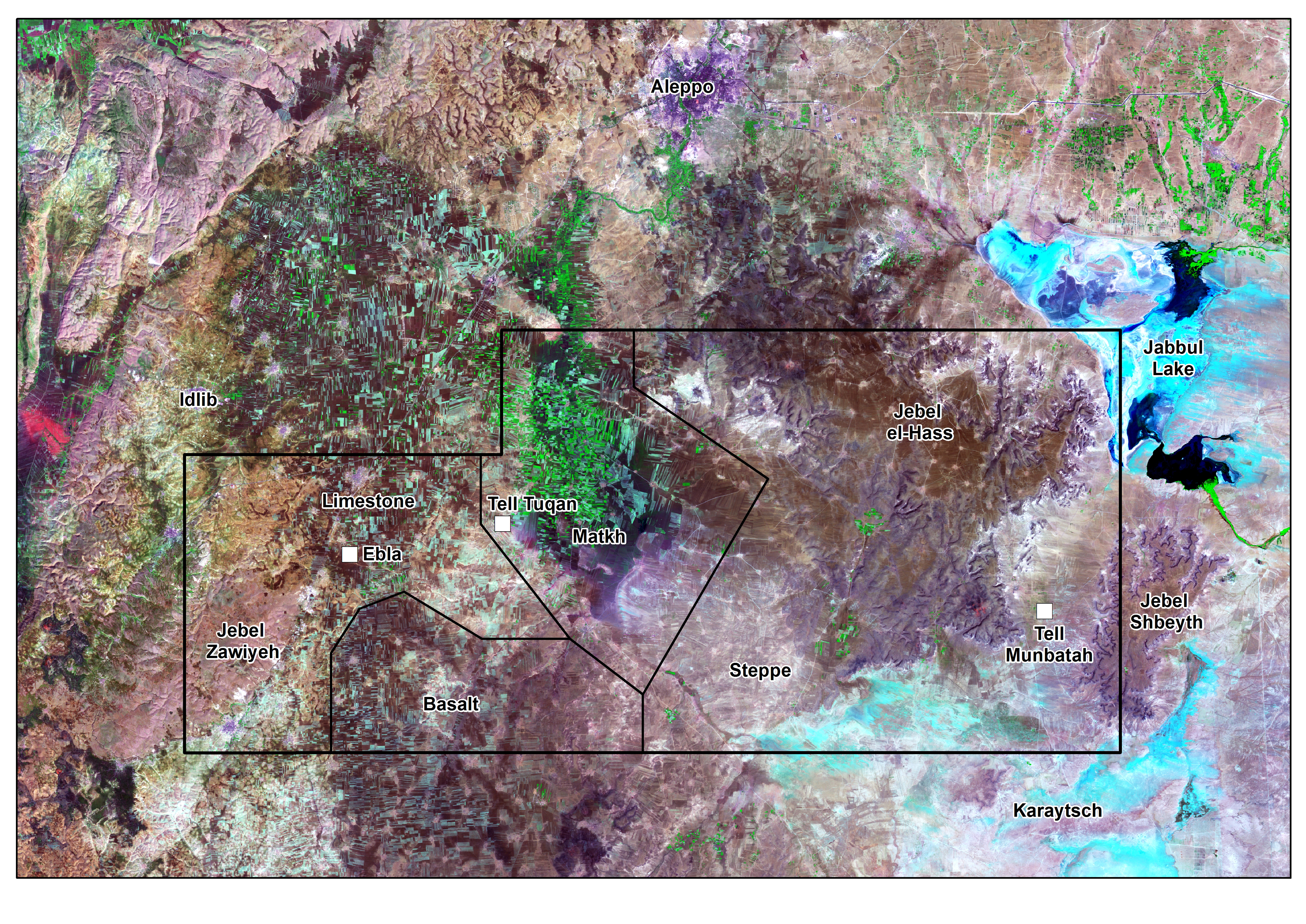
Ebla’s Landscape – Project Methodology
The project makes use of a dataset of available satellite imagery (e.g. CORONA, Landsat, WorldView-2 and Geoeye high-resolution images purchased in 2011, as well as colonial French and Soviet topographical maps and Syrian Army 1960s aerial photographs) in order to localize sites and record other categories of archaeological evidence such as field systems, land boundaries, communication routes and water management installations.
Digitization of hand-drawn topographic maps, pottery drawings and field notes, together with the implementation of a database to process data using a GIS programme, will yield the complete dataset required for spatial analysis. Moreover, the study of surface pottery finds and the dating of sites will benefit from the considerable progress made in recent decades by project team members in seriating material culture assemblages (MSAE series).
In addition to typological analysis, archaeometric characterization of pottery from the Eblaite chora is also planned, in order to broaden the dataset with MB-IA samples from Tell Mardikh/Ebla and other sites in the region. Ceramics will be studied using a multi-analytical approach employing both destructive and non-destructive analytical methods (XRF, XRD, polarizing optical microscopy and micro-Raman spectroscopy). The spatial analysis of vessel types and raw material composition will be used to produce a systematic classification of wares and types, in order to conduct a diachronic analysis of local developments and synchronic examinations of intra-regional interactions.
All data were entered in a GIS system based on Quantum GIS. Metadata are being stored in the University of Milan Dataverse®, an open-source research data repository software management system.
The final publication will contain contributions by specialists in various disciplines, a substantial amount of technical imagery (such as GIS-based thematic maps), archaeometric pottery analyses, and a detailed catalogue of sites and survey finds.
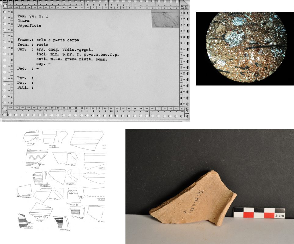
Example of the original documentation of Ebla stored in the MAIS archives at the Sapienza, University of Rome. Sample of a ceramic file; original drawings of the pottery from the stratified deposits at Ebla selected for archaeometric analysis.
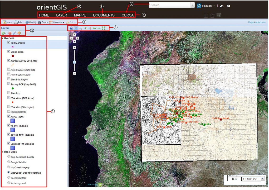
Structure of Ebla chora Web-GIS (Orient GIS).